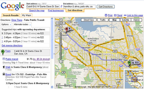
The public transit trip info includes stop location, travel time and fare, along with a driving cost comparison. Google Transit can handle connecting routes from multiple connecting transit agencies.
Although Google Transit has information on a number of U.S. and overseas transit agencies, more can certainly be added. In my area, for example, Santa Cruz Metro, Caltrain, SamTrans, SF Muni and AC Transit are all missing, among others. It's up to the transit agency to contact Google and provide the necessary information, so contact your local public transit agency and encourage them to participate in this system. For the transit agency, the primary benefit is more visibility to casual Google Maps users of available transit options.
Via.
No comments:
Post a Comment